Surveying Pole Tripod: Essential Tools for Precision Measurement
In the world of land surveying, construction, and geospatial measurement, accuracy and stability are paramount. The surveying pole tripod is a fundamental tool that ensures precise data collection, whether for topographic mapping, engineering projects, or GIS applications.
But what equipment is typically used alongside a surveying pole tripod? Let’s explore the key tools that enhance its functionality.
1. Total Stations
A total station is a critical instrument often mounted on a surveying pole tripod. Combining electronic distance measurement (EDM) with angle sensors, it provides accurate coordinates for mapping and construction layout. The tripod’s stability ensures minimal error during measurements.
2. GNSS/GPS Receivers
For real-time kinematic (RTK) surveying, GNSS receivers are paired with a surveying pole tripod to achieve centimeter-level accuracy. The tripod keeps the antenna steady, reducing signal interference and improving positioning reliability.
3. Laser Levels & Theodolites
When leveling or aligning structures, laser levels and theodolites are frequently set up on surveying pole tripods. Their adjustable legs allow for precise leveling on uneven terrain, ensuring straight reference lines and angle measurements.

4. Common combinations of prisms and surveying pole tripods
Single prism + surveying pole tripod (for static measurement)
Applicable scenarios: control point measurement, topographic surveying, construction layout.
Advantages: high stability, suitable for tasks that require long-term fixed observation.
360° prism + surveying pole tripod (for multi-angle measurement)
Applicable scenarios: tunnel engineering, mining measurement, large structure monitoring.
Advantages: can be observed from any angle, reducing the time for re-centering.

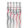
5. Prism Poles & Targets
Prism poles, used with total stations, are often stabilized by a surveying pole tripod for reflectorless measurements. This setup is common in construction site monitoring and deformation analysis.
6. 3D Laser Scanners
Modern 3D laser scanners sometimes use surveying pole tripods for static scanning applications. The tripod’s rigidity prevents movement during high-resolution data capture, essential for BIM and as-built surveys.
7. Digital Levels
For precise elevation measurements, digital levels are mounted on surveying pole tripods, ensuring consistent readings in road construction and civil engineering projects.

Conclusion
The surveying pole tripod is a versatile support system that enhances the performance of various high-precision instruments. From total stations to GNSS receivers, its role in maintaining stability and accuracy cannot be overstated. As surveying technology advances, the demand for robust and adaptable surveying pole tripods continues to grow across industries.
For professionals in construction, land surveying, or geomatics, investing in a high-quality surveying pole tripod—alongside compatible tools—ensures efficiency and reliability in every project.
